


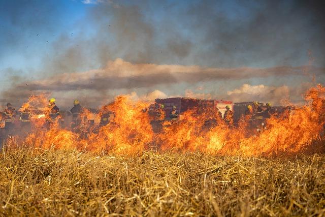
As Washington’s wildfire season escalates, the Kaiser Canyon Fire has become a defining event, exposing the limits of regional preparedness and the resilience of local communities. Burning through steep, hard-to-access terrain and fueled by prolonged drought and erratic winds, the blaze is reshaping daily life across north-central Washington and drawing attention from public health officials, climate researchers, and emergency managers alike.
Central to understanding this unfolding crisis is IQAir’s Wildfire Map, which delivers live updates on the fire’s behavior and its impact on air quality. By integrating satellite imagery, ground-based sensors, and real-time reporting, the platform tracks smoke plumes, PM2.5 levels, and evolving health risks. As incident commanders work to contain the Kaiser Canyon Fire, this data-rich map has become a critical resource for evacuation planning, public health guidance, and assessing the growing wildfire threat across the American West.
Kaiser Canyon Fire transforms communities, infrastructure, and landscapes
The Kaiser Canyon Fire has disrupted daily life far beyond the immediate burn area, forcing rural Washington towns to adapt to an entirely new reality. Communities surrounded by dry forests and shrub-steppe now face rolling evacuations, property loss, and lingering uncertainty about what the next wind shift might bring. School districts, small businesses, and agricultural operations are reworking schedules around smoke forecasts and road closures, while local governments grapple with the dual challenge of immediate response and long-term recovery planning.
Residents describe a new daily ritual: checking wind direction, reviewing current AQI readings, refreshing IQAir’s Wildfire Map, and scanning local alerts before deciding whether it’s safe to commute, work outdoors, or send children to sports practices. Emergency managers report that requests for timely air quality and evacuation information have surged as smoke spreads well beyond the fire’s perimeter.
- Primary impacts: Evacuations and displacement, hazardous air quality, and intermittent closure of critical transportation corridors
- Community response: Temporary shelters, volunteer support for firefighters, mutual aid agreements, and expanded local air quality monitoring
- Environmental shift: Loss of established forest cover, disrupted wildlife movement, changing habitat patterns, and increased erosion potential on burned slopes
- Economic pressure: Disruptions to farming and ranching, reduced tourism revenue, postponed outdoor events, and higher operating costs for local businesses
| Area | Key Change | Short-Term Outlook |
|---|---|---|
| Foothill communities | Expanded defensible space, updated evacuation zones, and new neighborhood response plans | Ongoing mitigation work and preparedness drills throughout the fire season |
| Forest interface | Extensive canopy loss, scorched hillsides, and damaged trails and access roads | Elevated risk of landslides, debris flows, and flash flooding during storms |
| River valleys | Accumulating ash deposits in waterways, frequent smoke inversions, and degraded viewsheds | Recurring periods of unhealthy air and potential impacts on water quality |
| Regional economy | Interrupted harvest timelines, canceled bookings, and reduced outdoor recreation | Recovery dependent on fire containment, air quality trends, and tourism confidence |
Kaiser Canyon Fire smoke drives regional air quality and health concerns
Smoke from the Kaiser Canyon Fire has now spread across multiple counties, pushing fine particulate concentrations into ranges the EPA classifies as unhealthy for sensitive populations and, at times, the broader public. Communities both near and far from the flames are experiencing gray skies, persistent smoke odor, and reduced visibility that hampers driving, aviation, and firefighting operations.
Health authorities emphasize that tiny PM2.5 particles can penetrate deep into the respiratory system, inflaming the lungs and placing added strain on the heart. For people living with asthma, COPD, or cardiovascular disease, even short-term exposure can trigger flare-ups. For otherwise healthy individuals, repeated smoke episodes can cause headaches, sore throats, eye irritation, and unusual fatigue. Recent research from agencies such as the CDC and World Health Organization has underscored that wildfire smoke exposure is linked to increases in emergency room visits for respiratory and cardiac issues, especially during multi-day smoke events.
- Children, seniors, and pregnant people are particularly vulnerable due to developing or weakened respiratory and immune systems.
- Outdoor workers—including farm laborers, utility crews, road workers, and construction teams—face extended shifts in compromised air, even as demand for their work increases during an emergency.
- Health systems are preparing for spikes in urgent care and ER visits related to breathing difficulties, chest pain, and smoke-related irritation.
| Location | Recent AQI Range | Health Guidance |
|---|---|---|
| Nearest fire-affected valley | 150–180 | Limit outdoor activity, especially for sensitive groups; use N95 masks when outside |
| Downwind urban center | 110–140 | Close windows and doors; operate indoor air filtration or HVAC on recirculation |
| Outlying rural areas | 80–110 | Monitor air quality regularly; scale back strenuous outdoor exercise and long outdoor shifts |
Public health agencies are urging residents to consult real-time air quality data and modify their activities accordingly. Recommendations include designating at least one clean-air room per household with portable filtration, postponing outdoor workouts during smoky periods, and regularly checking on neighbors who may lack access to filtered indoor environments. School districts and event organizers are increasingly using AQI thresholds—often informed by tools like IQAir’s Wildfire Map—to decide when to move sports practices indoors, cancel outdoor events, or modify schedules to avoid peak smoke conditions.
How residents can reduce health risks from wildfire smoke exposure
Medical and air quality experts monitoring the Kaiser Canyon Fire advise residents to treat heavy smoke days much like they would other significant environmental hazards: by acting early and using available data. Monitoring real-time readings via the IQAir AirVisual map, along with local alerts and state air quality dashboards, can help households and workplaces time their outdoor activities and protective measures.
When PM2.5 levels climb, specialists recommend staying indoors as much as possible, sealing windows and doors, and shifting HVAC systems to a recirculation setting to avoid drawing smoky air indoors. Using HEPA air purifiers in living rooms, bedrooms, or other frequently occupied spaces can dramatically reduce particle levels. Experts also advise avoiding indoor combustion sources during smoke events—such as candles, incense, wood-burning stoves, and unnecessary gas stove use—to prevent adding pollutants to already stressed indoor air.
- Wear protection outdoors: For essential trips outside during heavy smoke, use a well-fitted NIOSH-approved N95 or P2 mask that seals tightly to the face. Cloth masks and loose-fitting coverings do not adequately filter fine particles.
- Limit exertion: Reschedule intense outdoor exercise, yard work, and competitive sports, especially when AQI reaches unhealthy levels.
- Protect vulnerable groups: Children, older adults, pregnant people, and those with heart or lung conditions should follow stricter precautions, keep rescue inhalers and medications close, and consult clinicians if they experience symptom changes.
- Monitor symptoms: Seek medical advice if coughing, wheezing, chest discomfort, shortness of breath, or extreme fatigue persist or worsen.
| Air Quality | Recommended Action |
|---|---|
| Moderate | Consider reducing prolonged or intense outdoor activities, especially for sensitive groups |
| Unhealthy | Stay indoors as much as possible, run HEPA filtration, and relocate activities to cleaner indoor settings |
| Very Unhealthy | Avoid outdoor activity except for essentials; use a well-fitted N95 when going outside |
What the Kaiser Canyon Fire reveals about Washington’s wildfire readiness and future risks
The Kaiser Canyon Fire serves as a real-world stress test for Washington’s evolving wildfire strategy. On the positive side, rapid mobilization of air tankers and helicopters, swift incident command activation, and preseason fuel treatments around some communities helped slow the fire’s advance toward homes and critical corridors. Years of messaging about defensible space and emergency go-bags meant that some residents evacuated more quickly and systematically than in past incidents.
At the same time, the fire has highlighted persistent gaps. Crews have struggled with steep, rocky terrain and limited water access, complicating ground operations. Smoke impacts have extended far beyond the immediate fire zone, affecting communities that are not traditionally considered high-risk for flames but are clearly vulnerable to air quality degradation. State climate assessments have already warned that earlier snowmelt and hotter, drier summers will lengthen fire seasons; this incident aligns with those projections, with fine fuels reaching critical dryness weeks ahead of historical norms.
For planners and residents living in the wildland–urban interface, the Kaiser Canyon Fire reinforces that “fire season” is becoming a longer, more unpredictable period of elevated danger. It is accelerating conversations about where and how communities build, how they manage vegetation, and how they integrate air quality into emergency planning.
Authorities and land managers are signaling a shift toward:
- Year-round mitigation through prescribed burns, mechanical thinning, community chipping programs, and home hardening initiatives.
- Health-focused alerts that pair evacuation guidance with real-time air quality index information and recommendations for clean-air shelters.
- Infrastructure hardening for power systems, communication networks, and evacuation routes to remain functional during extreme heat, wind, and smoke.
- Public data tools—including live wildfire maps, smoke modeling, and hyperlocal monitoring networks—to help residents and decision-makers act quickly.
| Key Factor | Current Reality | Emerging Risk |
|---|---|---|
| Season Length | Earlier ignition dates and delayed season end | Greater overlap between incidents and increased strain on firefighting resources |
| Fuel Conditions | Drier forests, grasslands, and brush due to warming trends | Faster-spreading fires and more frequent extreme fire behavior days |
| Smoke Exposure | More frequent regional air quality advisories | Potential for chronic health impacts and long-term burden on healthcare systems |
| Community Preparedness | Varied levels of readiness across counties and municipalities | Disproportionate losses and health impacts in under-resourced areas |
The path ahead: living with fire and protecting public health
As containment lines are strengthened and weather conditions evolve, the Kaiser Canyon Fire stands as a clear signal of how intertwined climate, air quality, and emergency response have become in Washington. Tools like IQAir’s wildfire map are no longer optional extras; they are central infrastructure for households, first responders, health officials, and policymakers trying to adapt to fast-changing conditions.
In the near term, attention will remain focused on protecting lives and property, reducing smoke exposure, and assessing damage to ecosystems and infrastructure. In the longer view, the lessons learned from the Kaiser Canyon Fire will shape how communities plan, build, and prepare for future wildfire seasons.
For residents in the region, staying informed—and acting quickly on real-time air quality and fire updates—may be as crucial as any physical firebreak in limiting the long-term consequences of this event and those that follow.