


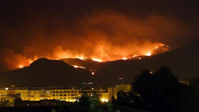
Police in Washington state say a man now facing arson charges spent considerable time studying how to trigger the most destructive wildfire possible before allegedly setting a blaze that ripped across parched land, threatened neighborhoods and drained firefighting capacity. Court records reviewed by investigators and reported by outlets including The Guardian indicate the suspect is accused of analyzing weather forecasts, vegetation conditions and topography to identify the moment and location most likely to drive rapid fire spread.
The case has intensified concerns about deliberate arson in an already severe fire season, especially in the US Pacific Northwest. In this region, hotter summers, extended drought, dense fuel buildup and expanding development at the wildland–urban interface have combined to heighten the danger of human‑caused wildfires. According to the National Interagency Fire Center, human activity is responsible for roughly 85–90% of US wildfires in recent years, raising the stakes when one of those fires is not accidental but meticulously planned.
Inside the Washington wildfire investigation: from online searches to alleged “blueprint” for destruction
Detectives say their case began to take shape when they pieced together a digital trail running from public computer terminals to devices seized at the suspect’s home. Search warrant affidavits state that the suspect’s alleged online activity included highly specific queries such as “fastest wind-driven fire spread” and “structures most vulnerable to ember attack”, along with downloads of research articles on fire ecology, suppression tactics and disaster logistics.
Investigators then reportedly aligned those timestamps with camera footage and license-plate records placing the suspect near several eventual ignition sites in the days leading up to the fire. During a search of his residence, officers say they recovered a notebook described as a hybrid of personal journal and field log: sketches of rural roads, arrows showing probable wind direction, notes on forecast humidity levels and observations about powerline activity and traffic patterns at different times of day.
For prosecutors, the convergence of this material indicates more than idle browsing. They argue it reveals a structured plan designed to exploit peak dryness, prevailing winds and local infrastructure vulnerabilities—what one investigator characterized as “a playbook for turning a bad fire day into the worst possible scenario.”
Evidence summaries submitted to the court describe what authorities view as repeated trial‑and‑error efforts to refine methods that could magnify chaos and delay response. They highlight:
- Target selection: Preference for isolated, forested stretches with single narrow access roads.
- Weather monitoring: Persistent tracking of Red Flag warnings, wind gust projections and overnight humidity shifts.
- Infrastructure mapping: Focus on older power poles, nearby fuel storage, propane tanks and rural service yards.
- Escape routes: Pre‑identified backcountry roads and logging tracks chosen over more visible highways.
| Key Focus | Investigators’ Interpretation |
|---|---|
| Wind corridors | Used to steer flames toward homes and outbuildings |
| Fuel loads | Sites picked for heavy, dry brush and logging slash |
| Access limits | Chosen to slow engines and complicate crew deployment |
| Timing at dusk | Likely aimed at reducing early aerial and reconnaissance response |
Defense lawyers counter that much of the digital material reflects “morbid curiosity” about disasters—a phenomenon hardly unique in the age of online true‑crime communities—and insist that the prosecution is reading intent into ambiguous behavior. But investigators say the apparent alignment between the suspect’s alleged research, his movements, and the fire’s observed spread pattern is too tight to dismiss, and they are seeking to frame it as evidence of calculated arson rather than a spontaneous act.
How online tools and modern planning methods are changing the threat of intentionally set wildfires
Authorities say the Washington case underscores a broader, unsettling shift: someone intent on setting a wildfire no longer needs insider access to technical information. With a smartphone or a library computer, a motivated individual can tap into:
- Public wildfire and fire spread simulators, originally designed to help agencies plan evacuations and fuel treatments.
- Satellite‑based fuel and risk maps that show where vegetation is driest and most continuous.
- Online courses, webinars and step‑by‑step content that explain how terrain, weather and fuels interact during a blaze.
- High‑resolution wind and weather apps that pinpoint when conditions are primed for rapid spread and ember cast.
These resources exist to make communities safer and to support transparent risk communication in a warming climate. Yet investigators warn that, misused, the same data can serve as a guide for choosing ignition points, exploiting canyon “chimneys” and drainages, and aligning a spark with the hour of strongest downslope wind.
As a result, fire and law‑enforcement agencies are expanding how they approach human‑caused fires. It is no longer enough to read burn patterns and witness accounts. Digital forensics now play a central role:
- Reviewing search histories for repeated, highly technical wildfire queries.
- Checking downloaded apps and offline maps against ignition sites and timelines.
- Analyzing GPS traces, saved routes and geotagged photos for reconnaissance behavior.
- Correlating digital footprints with physical evidence, such as accelerant residues or ignition devices.
At the same time, some agencies are reevaluating how much granular information they publish in real time. While transparency remains a core value, officials are debating whether extremely detailed public tools—like street‑level fuel hazard layers or live suppression‑resource maps—could unintentionally help someone “game” the system.
| Online Tool | Legitimate Use | Misuse Risk |
|---|---|---|
| Fire spread simulators | Scenario planning, evacuation timing, resource allocation | Optimizing ignition locations for fast growth |
| Fuel and risk maps | Home‑hardening decisions, zoning and mitigation projects | Pinpointing the driest, most contiguous fuels |
| Wind and weather apps | Public smoke forecasts, firefighter safety planning | Timing fires with peak gusts and unstable conditions |
Weaknesses in wildfire prevention that let a calculated arson plot escalate
Investigators say the suspected arsonist appeared to have a keen sense of where Washington’s wildfire defenses were thinnest. The alleged plan took advantage of:
- Lightly monitored forest corridors with limited cameras, sensors or regular patrols.
- Outdated detection technology that still leans heavily on human lookout reports and 911 calls.
- Fragmented communication systems across counties and special districts, slowing the flow of real‑time information.
- Volunteer fire departments covering vast, rugged terrain with minimal staffing during weekday hours.
Officials say the suspect appears to have chosen ignition zones where fuels were known to be heavy, relative humidity would be at its lowest, and local agencies had fewer eyes on the landscape. In rural areas, initial reports of smoke often come from ranchers, drivers or recreationists rather than automated systems. Even a delay of 20–30 minutes in confirming a start can be crucial on a day of high winds and single‑digit humidity.
Fire analysts and policy observers argue that prevention strategies have not fully adapted to the reality that some wildfires may be intentionally engineered. Public messaging has historically centered on accidental ignitions—unattended campfires, debris burning, fireworks, equipment sparks—rather than on carefully coordinated arson involving multiple near‑simultaneous starts or deliberate attempts to overwhelm response.
Preliminary reviews of the Washington incident suggest that:
- Existing early‑warning tools were calibrated to detect individual, larger smoke columns rather than clusters of small, coordinated ignitions.
- Interagency alert systems were slow to integrate reports from separate jurisdictions into a unified picture of a possible arson pattern.
- Training and tabletop exercises in many areas still focus more on lightning outbreaks and accidental starts than on high‑impact, premeditated arson scenarios.
| Weak Point | How It Was Exploited |
|---|---|
| Remote terrain | Ignitions set far from quick engine access or resident reports |
| Old detection tech | Reliance on manual lookout and phone calls delayed alarms |
| Data silos | Separate agencies lacked immediate shared situational awareness |
| Public messaging | Campaigns emphasized accidental fires, not deliberate, strategic arson |
Policy and enforcement measures experts say are critical to deter high‑impact arson
Criminal justice experts, wildfire scientists and emergency managers increasingly agree on one point: the most effective deterrent for calculated wildfire arson is the combination of rapid detection and a credible threat of serious legal consequences. Symbolic penalties, they warn, are unlikely to sway someone willing to study the landscape and exploit extreme conditions.
Specialists are calling for several concrete steps:
- Dedicated wildfire arson units staffed by investigators who understand both fire behavior and digital forensics, supported by satellite heat‑detection, camera networks and AI‑driven pattern analysis for spotting suspicious ignition clusters in near real time.
- Enhanced sentencing frameworks that scale with the level of risk and damage—including mandatory minimums when fires are set during Red Flag conditions, around critical infrastructure, near evacuation‑limited communities or in ecologically sensitive habitats.
- Specialized training for rural law enforcement so deputies, game wardens and highway patrol officers can recognize early signs of scouting behavior or ignition preparation along roadsides, trailheads and power corridors.
- Investment in forensic fire labs capable of reconstructing ignition patterns, identifying accelerants and providing robust evidentiary support for prosecution.
Beyond criminal penalties, policy analysts argue that fire‑prevention rules must assume that potential arsonists may be studying hazard maps and weather data as closely as firefighters do. That means:
- Tightening access to high‑risk zones on days of extreme fire danger, including temporary road and trail closures in particularly vulnerable corridors.
- Stricter controls on ignition‑prone activities near dry vegetation—such as certain industrial operations, off‑road vehicle use and utility work—when winds and humidity cross critical thresholds.
- Real‑time coordination between utilities, land managers and emergency services so that risk maps, planned power shutoffs and patrol patterns are aligned during peak danger windows.
- Community reporting networks that empower residents, ranchers, recreation groups and volunteer fire districts to quickly flag unusual activity, paired with clear legal protections for those who report in good faith.
Recommended structural reforms include:
- Mandatory risk‑based sentencing that explicitly factors in the lives, homes, public infrastructure and wildlife habitat placed in jeopardy, not just acreage burned.
- Cross‑border data sharing so that known arson patterns, suspicious vehicle descriptions and active investigations follow suspects across county and state lines.
- Year‑round public alerts explaining not only daily fire danger levels but also the severe criminal liability tied to intentionally starting a blaze, including potential restitution for suppression costs and long‑term damage.
| Priority Action | Main Goal |
|---|---|
| Special wildfire arson units | Increase detection speed and investigative quality |
| Risk‑weighted penalties | Align punishment with ecological, economic and human harm |
| Community tip networks | Catch suspicious activity and fires at or near ignition |
| Tech‑driven surveillance | Deter repeat offenders and expose coordinated plots |
Key Takeaways
Authorities emphasize that the Washington investigation is still unfolding, and prosecutors have indicated that more charges could be added as they evaluate additional witness statements, digital records and lab results. The alleged arson comes amid a period of heightened anxiety over human‑caused wildfires in the Pacific Northwest, where climate‑driven heat waves and prolonged drought have amplified the stakes of every ignition.
As the legal process moves forward, officials are urging residents to treat suspicious roadside stops, unusual activity near power infrastructure and unexplained smoke reports as matters requiring immediate attention. In a landscape primed by extreme weather, they warn, a single deliberate spark can trigger a regional emergency.
The accused remains in custody awaiting trial, while Washington grapples simultaneously with the immediate consequences of a punishing wildfire season and the longer‑term challenge of preventing high‑impact arson in an era of rapidly changing fire behavior and unprecedented access to technical information.